There is a distant highway that stretches all the way from Krygyzstan to Tajikistan. For 1500 long and lonely kilometers give or take, this highway winds its way from one country to the next through the Pamirs – a region of soaring snowcapped mountains, rocky valleys, barren plateaus, and high-altitude passes. The people who live in this starkly beautiful, wild place have romantically dubbed it ‘The Roof of the World’. The Pamir Highway itself, less romantically, is officially called the M41. Climbing to its ultimate height at 4,655 metres, it’s the second-highest highway on earth.
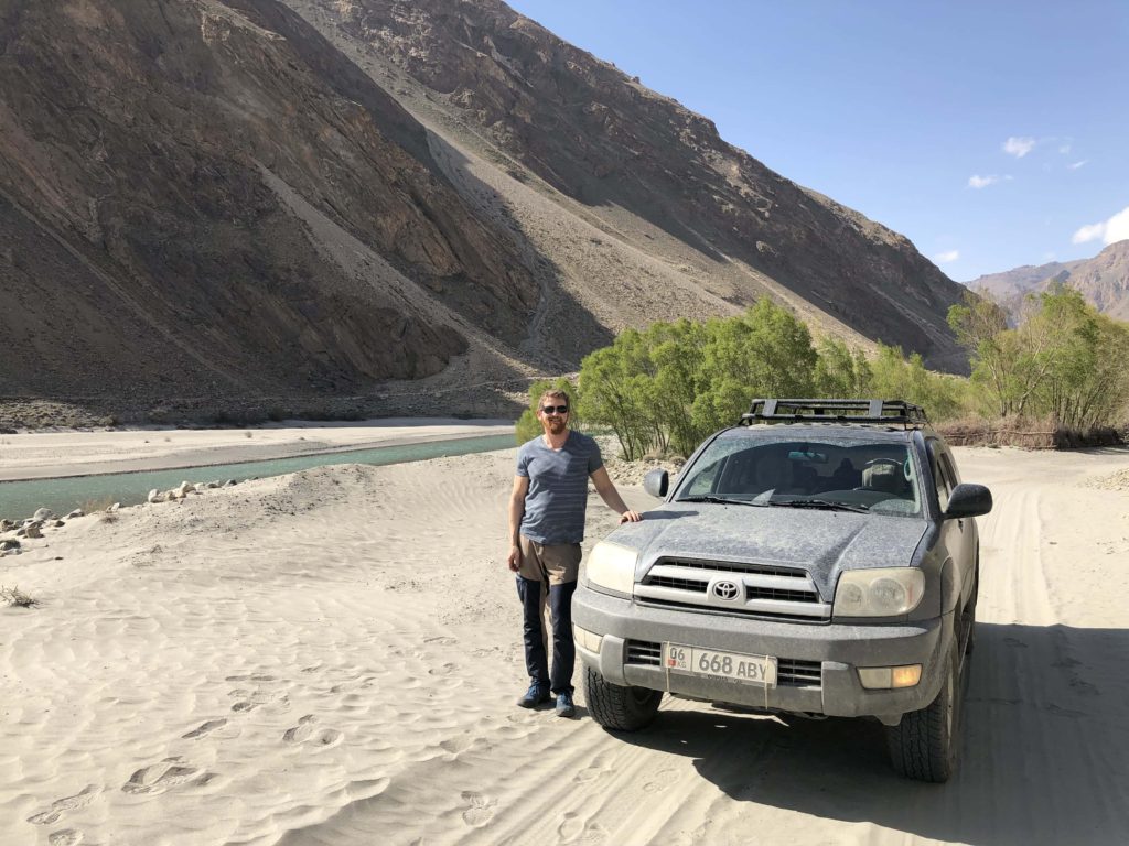
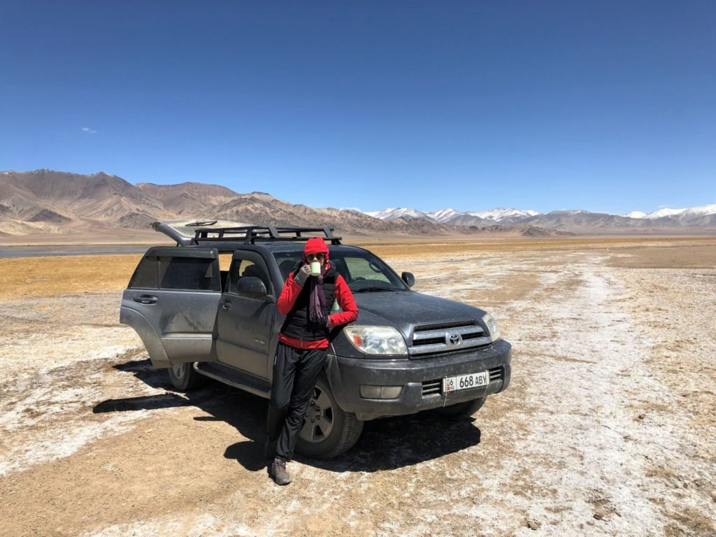
Travelling the Pamir Highway from end to end is one of the world’s greatest roadtrips. We aren’t the best advance-planners, and I don’t even have a driver’s license, but the very idea of this road had a grip on us both and that was enough. So we hired ourselves a Toyota Forerunner from an agent in Kyrgyzstan, and that’s how the whole thing started.
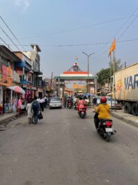
We’d arranged to pick the car up in Dushanbe, the capital of Tajikistan and home of the world’s tallest flagpole (you’d think they could be content with the second-highest highway, but no). Since we rarely start a trip in the country we’re actually aiming for, we travelled down from Almaty in Kazakhstan, via Uzbekistan on the way. And that’s how we ended up in Samarkand one night at a restaurant decorated by somebody with really awful taste in everything, having a mini-mental breakdown at the realisation that we were about to head pretty high up into some pretty remote mountains without much of a clue about what we were doing. Driving the Pamir Highway isn’t just a matter of hopping in the car with your phone and a latte. There are things to bring, a route to map out, stops to consider.
So despite not being advance-planners, we did our research and planned to get to Dushanbe with a day to spare. We’d spend that spare day grocery shopping, organising stuff, and marvelling at the world’s tallest flagpole. We’d get a good night’s sleep and well rested, we’d calmly set off on the highway.
Instead, delayed by rockslides blocking the road from the Tajik border to the capital we arrived in Dushanbe the evening before we were due to set off. We spent a couple of hours running madly around a supermarket throwing ramen noodles and instant coffee into the trolley, and didn’t even get a glimpse of the flagpole.
But we were ready.
The next morning we loaded the car and drove out of Dushanbe, excitement and anticipation running high.

During the chaos the night before Oyv apparently managed to eat something that disagreed with him and he pulled over to throw up three times. Even that couldn’t dampen our enthusiasm. After all, we were on the road at the very start of the famous Pamir Highway, ready to travel into the unknown and see what we could find there.
Here’s some of what we found.
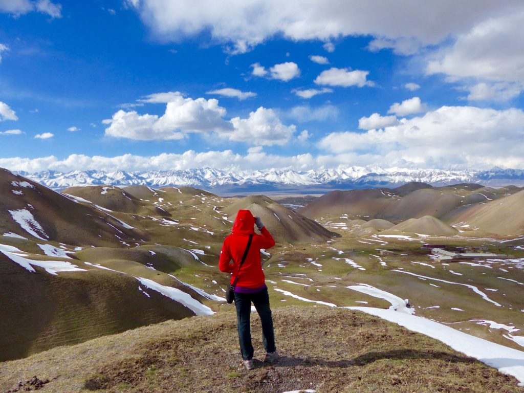
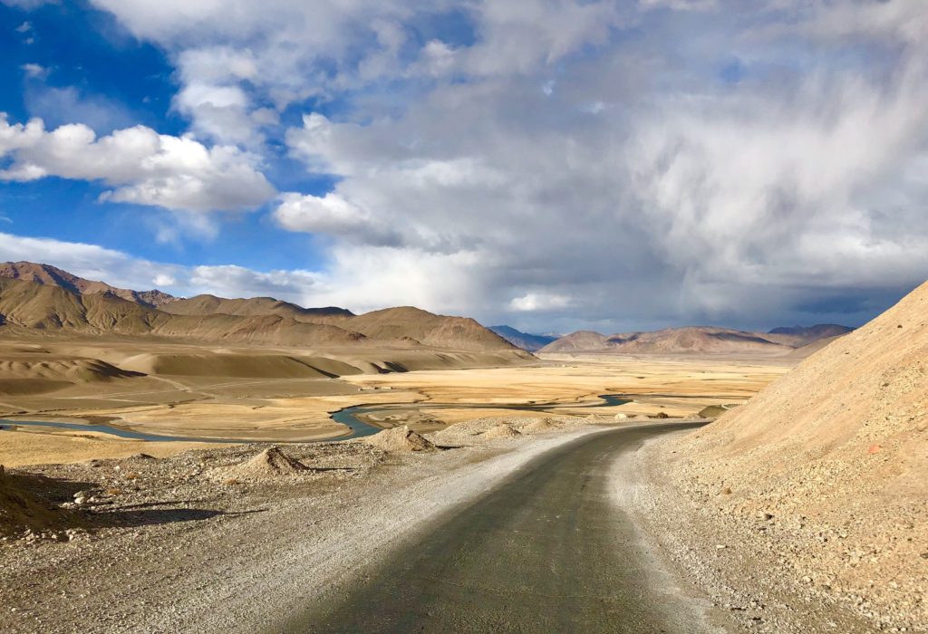
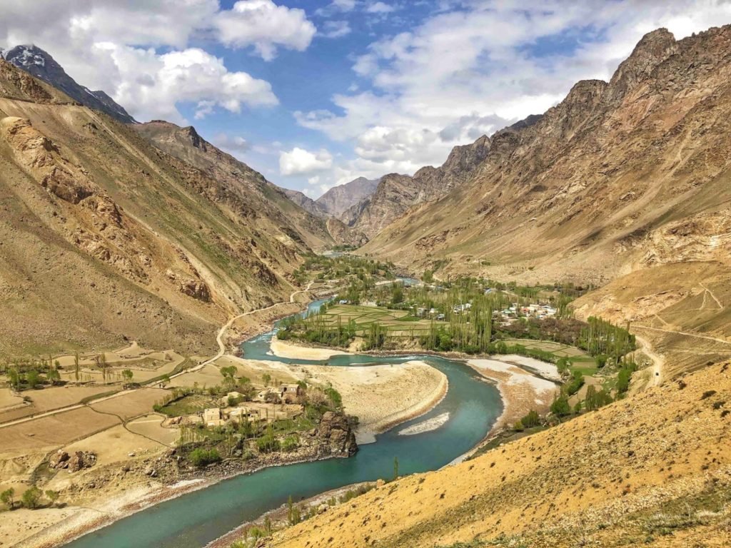
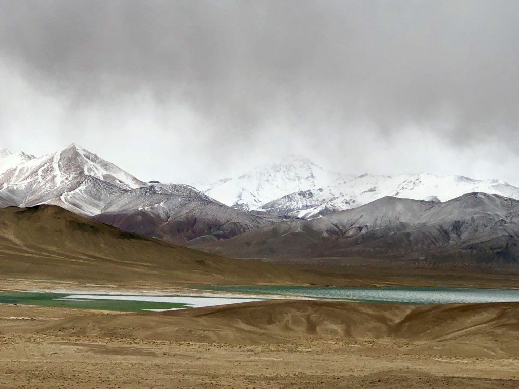
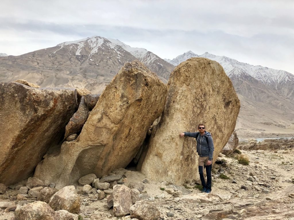
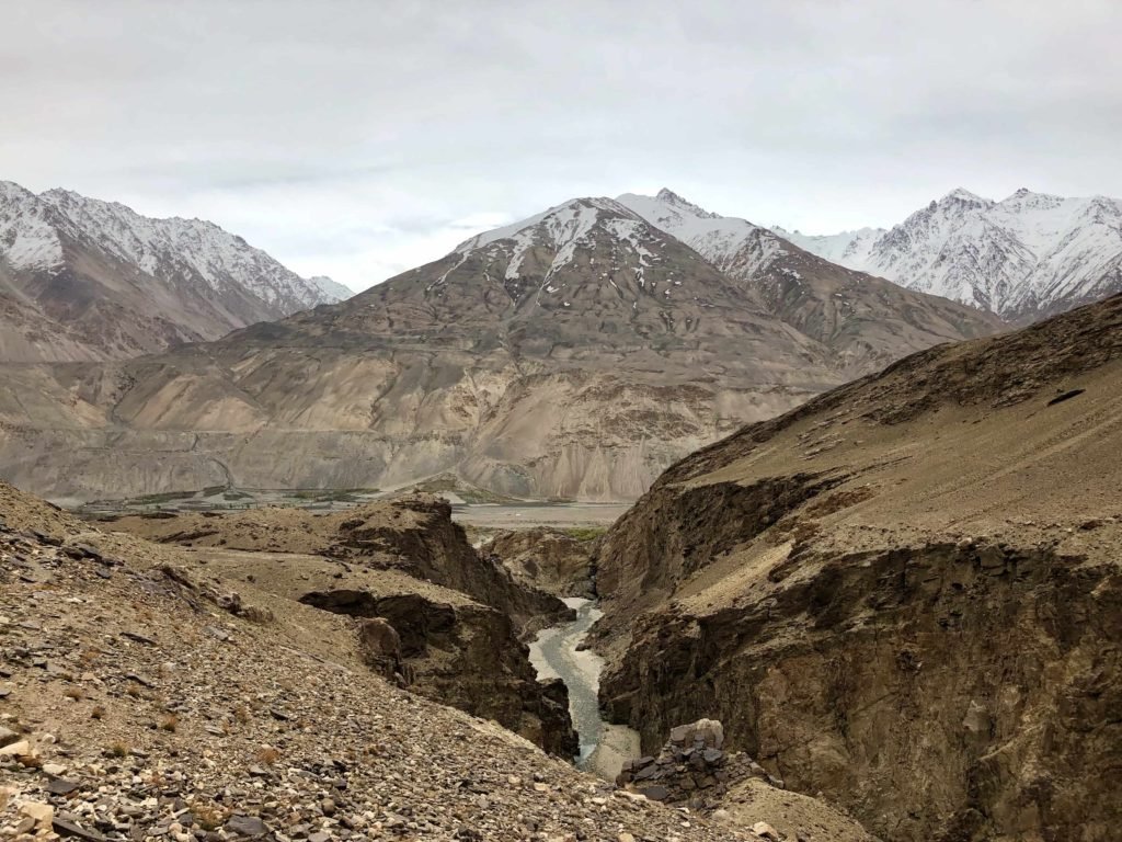
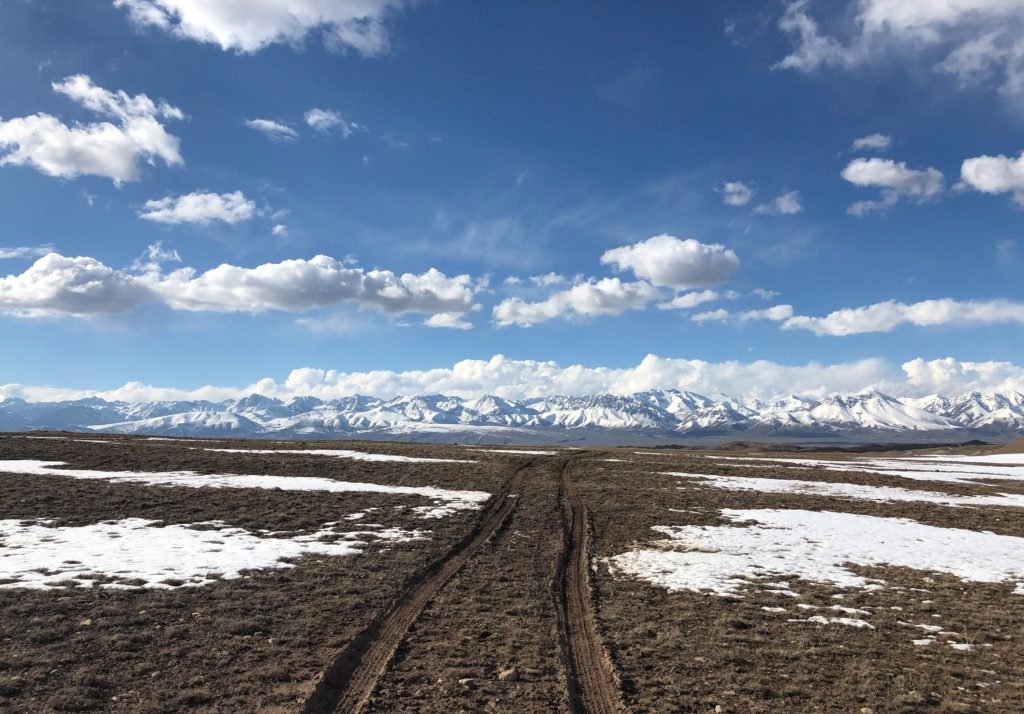
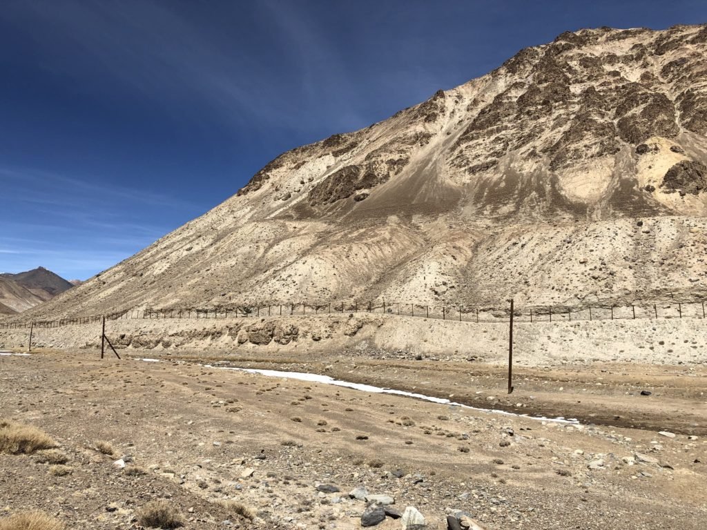
Stunning Landscapes
Mountains and moonscapes, alpine lakes, winding rivers – this is a truly beautiful part of the world.
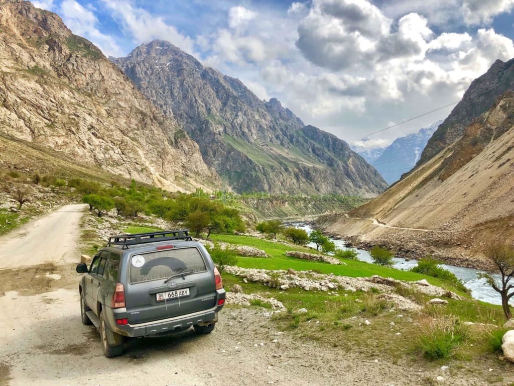
When the road wasn’t etched into the side of a mountain, it stretched out in front of us through endless stark plateaus or green valleys.
Sometimes the road turned unexpectedly to sand.
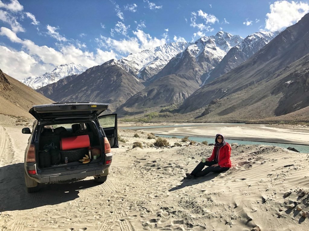
Off-roading, we reached shimmering mountain lakes, frosted with ice at the edges.
These are the kinds of places we stopped to just look at, a dozen times a day.
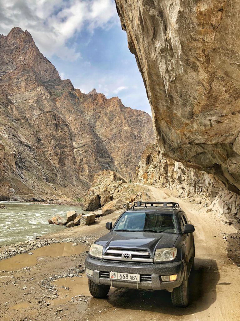
Adventure
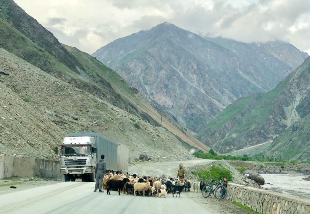
An ever-changing and wild landscape naturally brings some adventure with it. Steep dirt roads with hairpin turns twist up mountainsides and plunge back down to valleys far below.
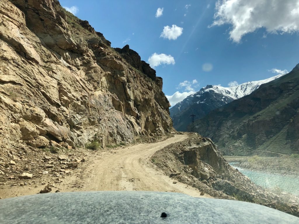
Sometimes we felt like we were the only people in the Pamirs, driving in solitude and rarely passing another vehicle.
Best of all, there’s the sense of total freedom that comes with having your own car…to just, you know, drive around Tajikistan.
When you take each day as it comes, every one of them is a potential adventure.
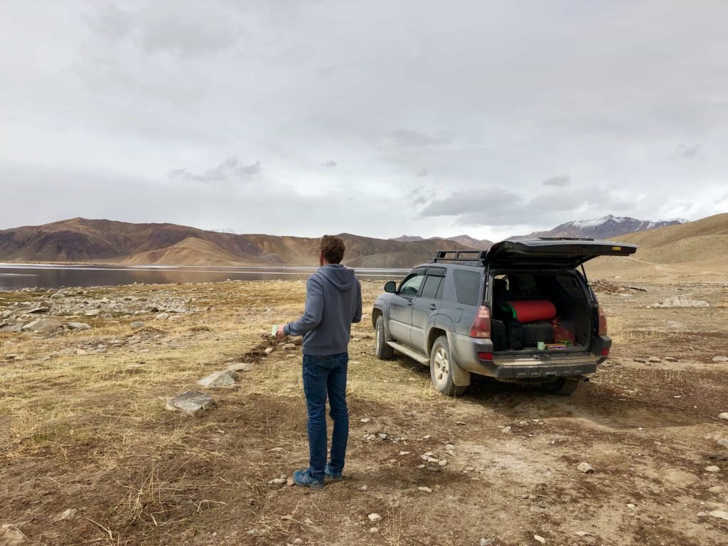
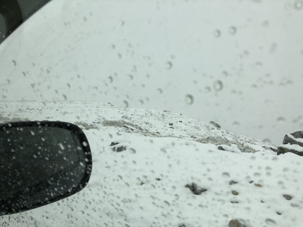
High-Altitude Passes
There’s no other way to get through all those mountains. A blizzard on Khargush Pass nearly forced us to turn back. Blinding snow accumulated on the narrow road, whiting out my view of the sheer drop on the right side as we inched along.
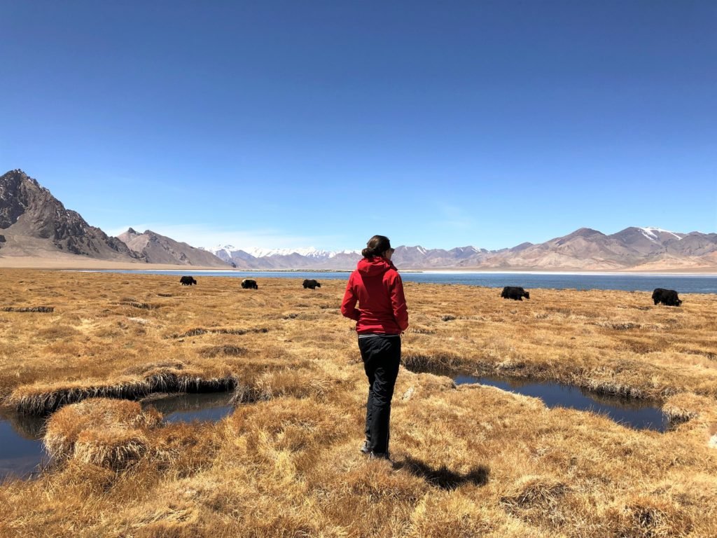
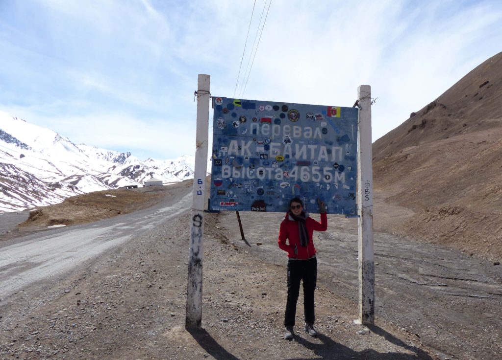
At 4,655 metres, Ak-Baital is the highest pass on the trip, and one of the most desolate places we ventured through.
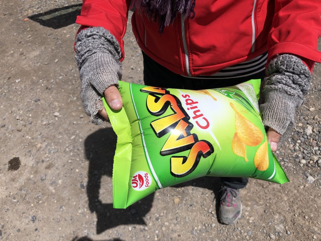
The altitude here also really took a toll on our snacks.
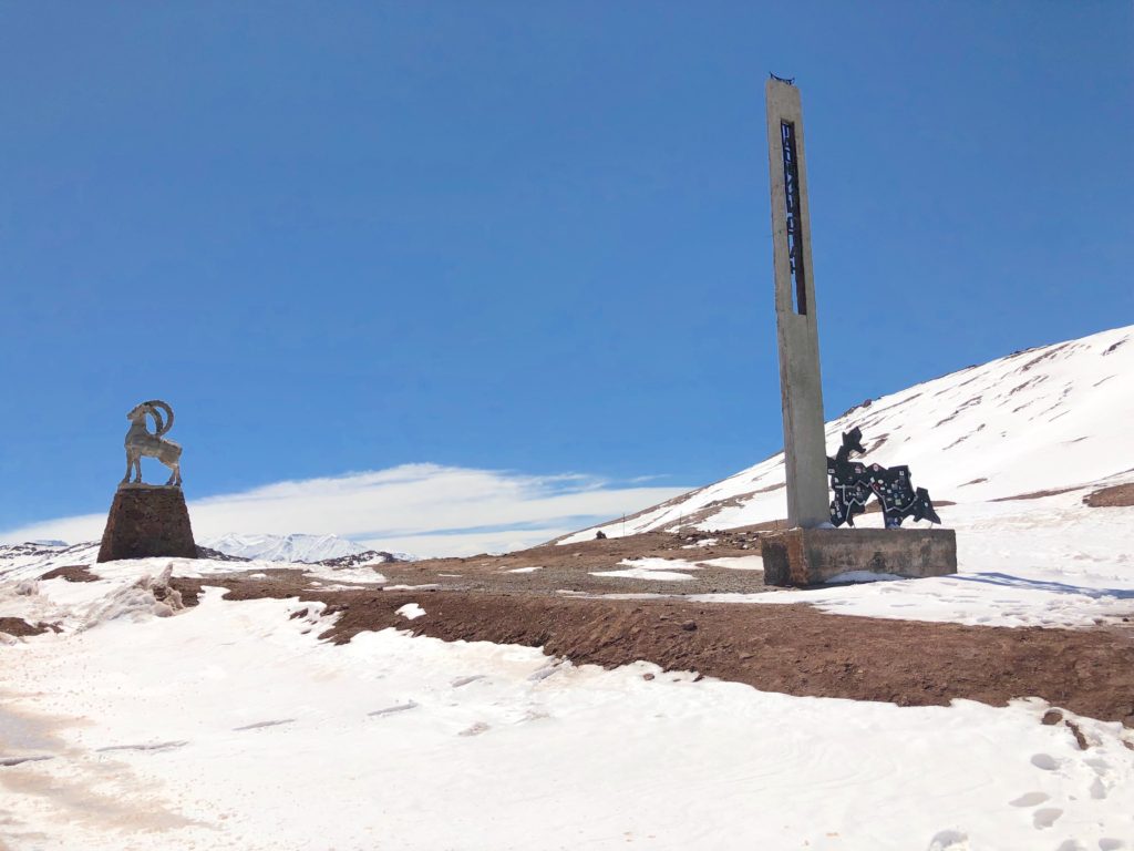
And then there’s Kyzyl-Art pass, the remote mountain border where we left Tajikistan behind and crossed into Kyrgyzstan.
Borders
Mountains and rivers make good borders. Good borders with Afghanistan, to be exact.
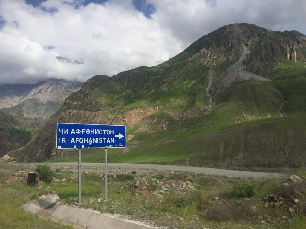
As the owner at our homestay said to us one evening, ‘The Pamirs are safe. The war is over there.’ He pointed out the window at Afghanistan on the other side of the valley.
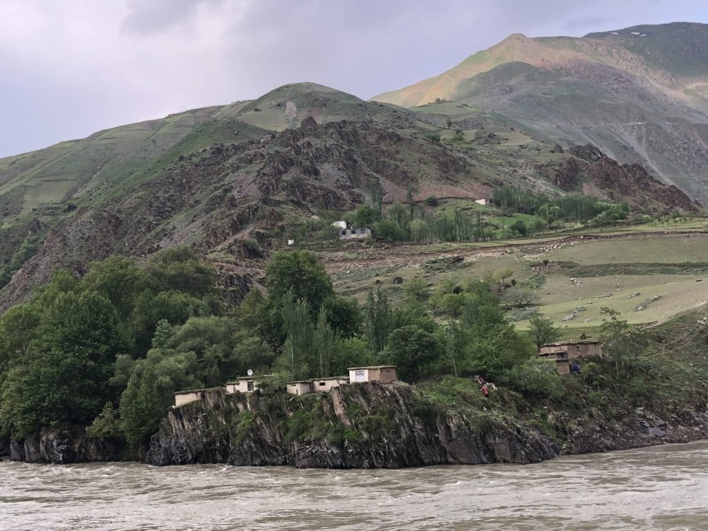
A narrow river forms the Afghan border and the road trails it for days, right past busy villages and a mountainside track running parallel to our own. At times we were no more than 50 meters from the other side – it’s a bit surreal.
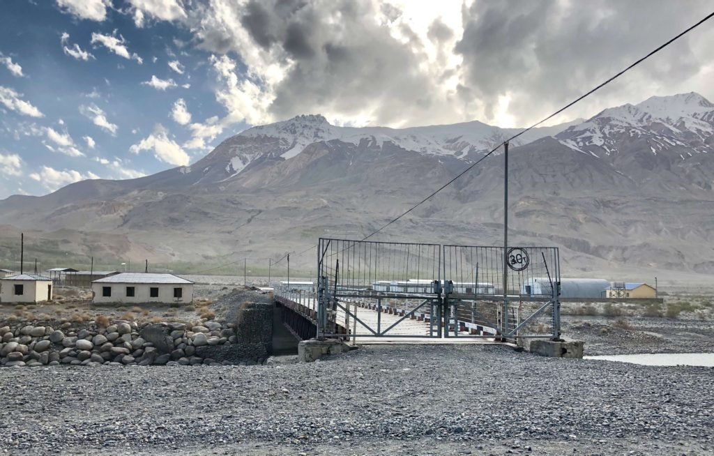
And once we ran out of Afghan border, the road followed an endless barbed wire fence demarcating the neutral zone between Tajikistan and China.
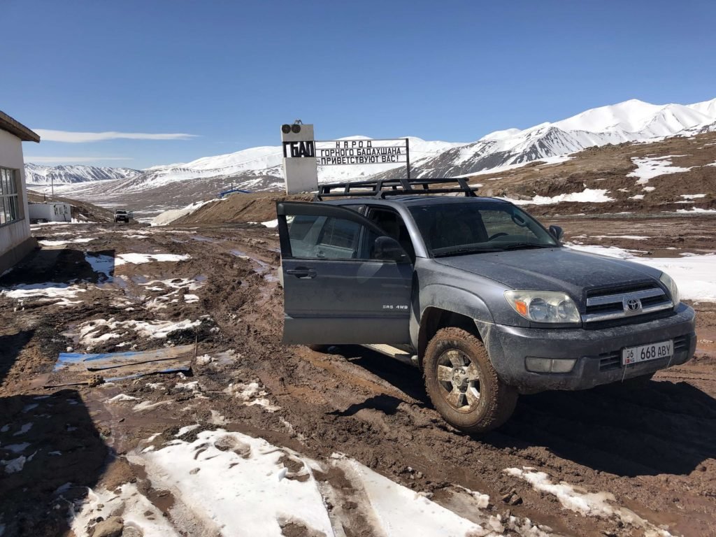
Checkpoints
This part of Tajikistan is called Gorno-Badakhshan, and it’s a separate region with its own entry requirements. That means there are military checkpoints here and there. We’d read that soldiers at these checkpoints could sometimes be problematic (read: demand bribes) but we didn’t encounter a single issue. Sometimes they just waved us right through without even looking at our documents; other times they stopped us only to make sure we were fine. The most ‘harassment’ we ever faced was a few guards who wouldn’t let us past until we’d stopped for chai.
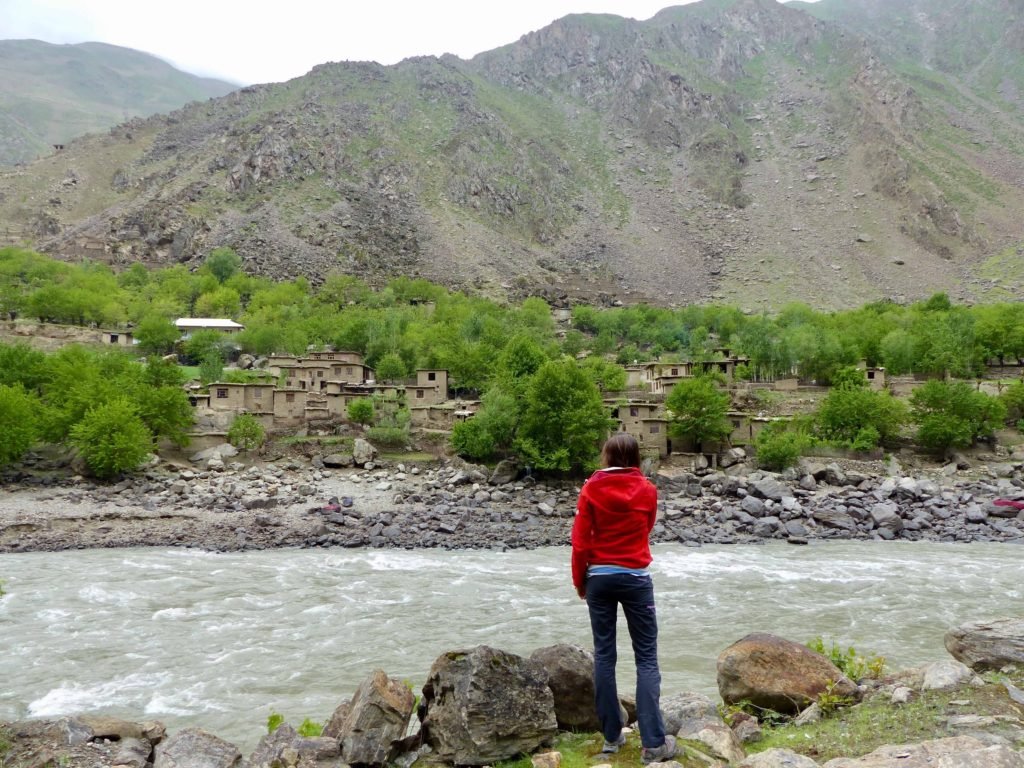
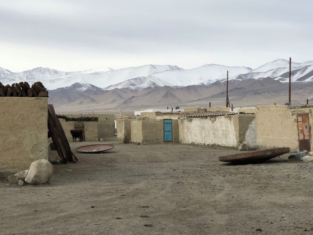
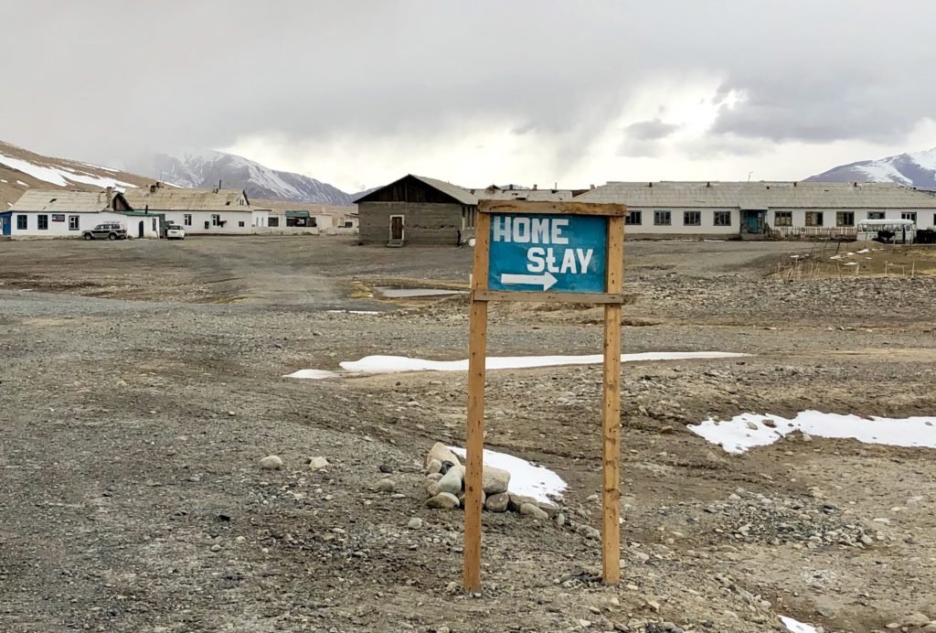
Remote Villages
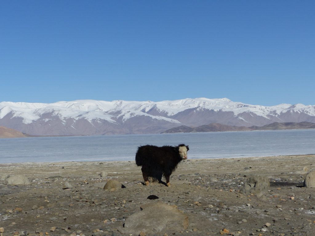
When I say remote I mean…seriously remote. It’s hard to believe sometimes but – people live here. We’d drive for hours without signs of life and then pass a village that wasn’t much more than a scattering of rusty shipping containers on a bleak, windswept plain. Maybe a few yaks wandering the streets.
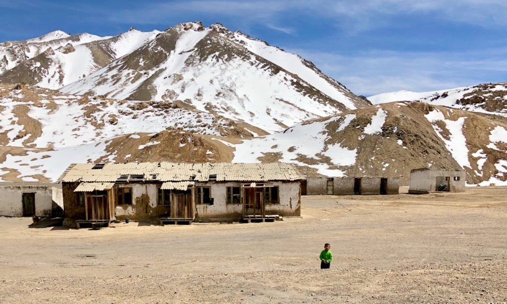
The exception to this desolate emptiness is the Wakhan valley (which is actually a detour off the highway), where there is a string of friendly villages. Locals get around either by very sporadic public transport in the form of shared jeeps, or by hitchhiking. We picked up as many hitchers as we could fit in the car on this leg of the journey.
These kids were our favourite passengers. We picked them up basically on the top of a cliff, and drove them down to their village below.
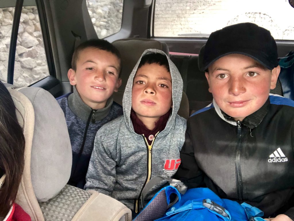
They didn’t have much English but they did know ‘car’, ‘brake’ and ‘stop’, which I took to be critiques of Oyv’s driving on the steep descent.
Every village has a homestay or two where guests can sleep for the night – Pamiri-style, on mattresses in a big room with a central oven, under thick, heavy blankets.
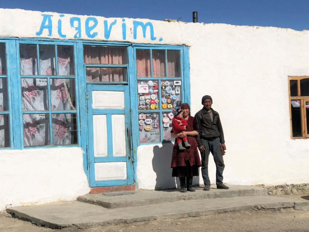
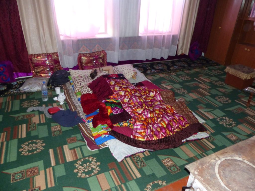
Our homestay hosts also fed us dinner and breakfast, and the chai-supply is endless.
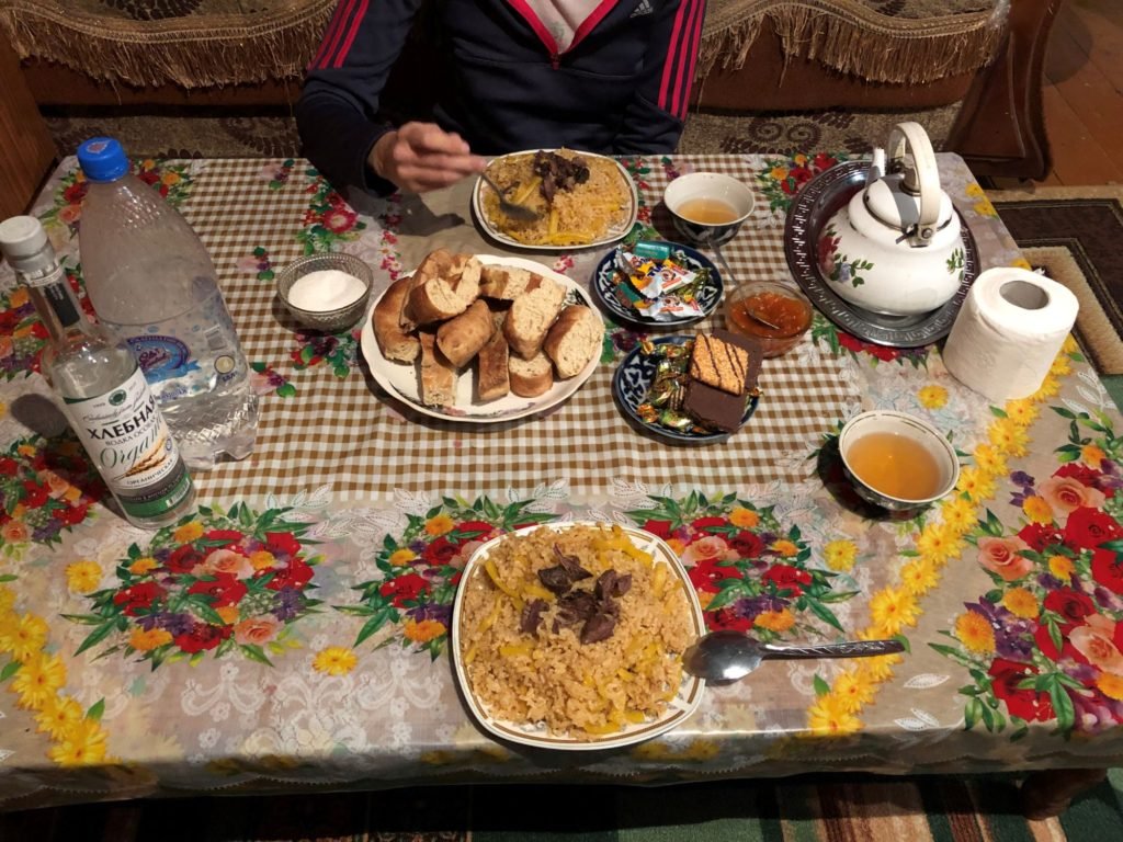
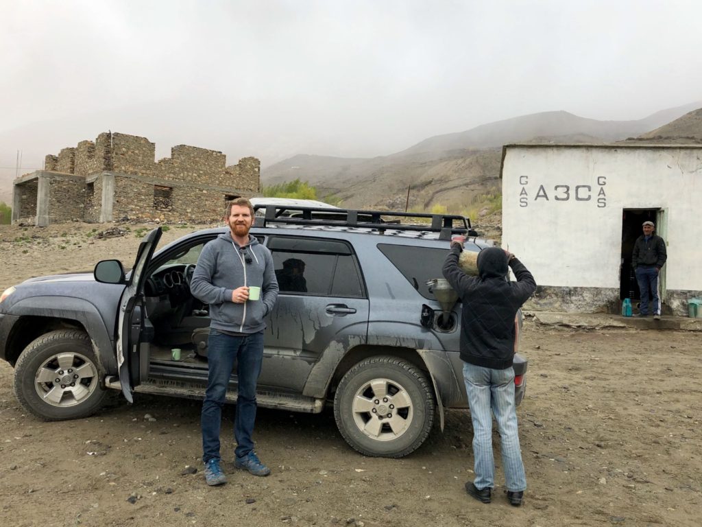
Petrol is pretty easy to come by too.
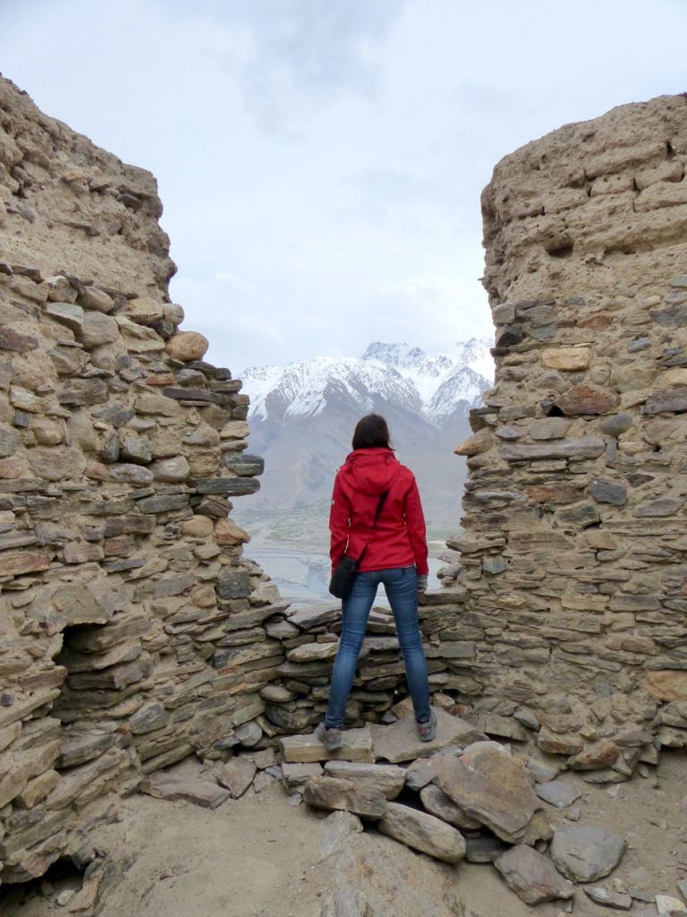
History
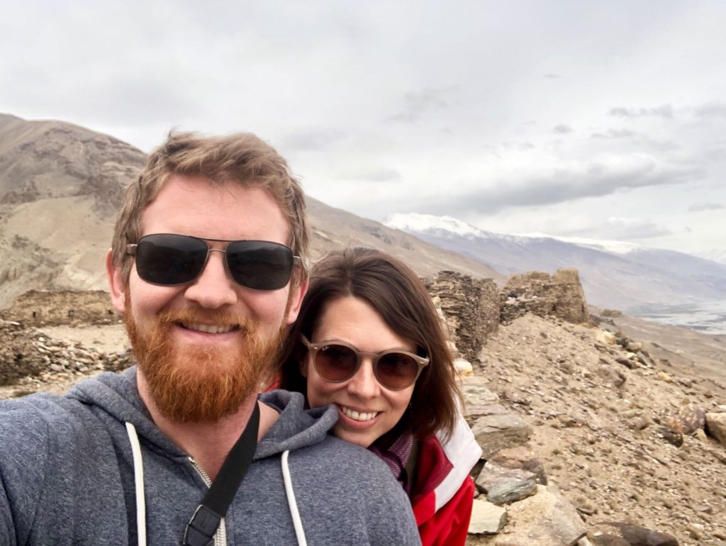
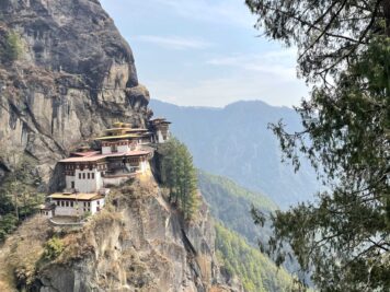
People not only live here today – they’ve been here for a while. The Wakhan valley was once a part of the Silk Road and it is still dotted with shrines, tombs, stupas, and the ruins of ancient fortresses. Built as far back as the 3rd century BC to protect traders on the road, some of these forts have been put to use by one culture after another, most recently serving as military watchposts during Tajikistan’s civil war in the 1990s. Today they offer the opportunity to climb up and scramble around tumbledown castles in the middle of nowhere, often all alone (so don’t fall).
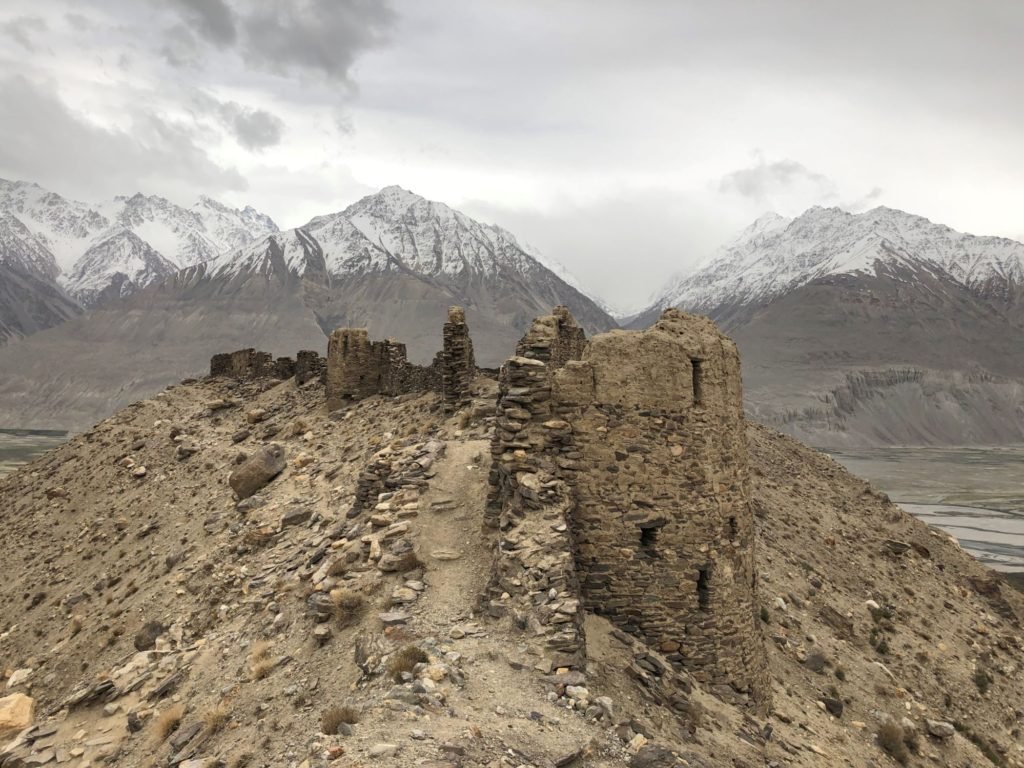
The best preserved is Yamchun Fortress, where despite centuries of earthquakes and landslides, the ruins cling to a lonely hilltop overlooking Afghanistan. We climbed up onto the crumbling walls and looked out over the valley – time seems to stand still here.
…And Back to Reality (Osh)
After eight days exploring along the Pamir Highway we reached the end of the road, in Osh, Kyrgyzstan. It was hot and sunny there and we desperately needed to change out of our long underwear and peel off some of the layers we’d been wearing non-stop in the chilly mountains. We parked the car at a cafe – by day three of nothing but Nescafe we’d started fantasizing about coffee. So we drank lattes in the cafe – instead of instant coffee on a sandy riverbank looking into Afghanistan, or on the shores of an alpine lake, or beside an empty road stretching forever into the distance. It was good coffee but there’s definitely something to be said for a cup of Nescafe on an epic roadtrip.
Read More
Want to know how we pulled this trip off? Take a look at our guide to self-driving the Pamir Highway for our trip itinerary and important practical details.
This Post Has 2 Comments
Excellent report! Longer than your usual ones but worth the read. The Stans is an area I’ve long been interested in and I have a rough itinerary in my own mind for when I finally get around to going there. Great post this time! – Andrew
Thanks! Yeah, it’s an interesting area for sure, and a lot of options for your itinerary:)