The steep dirt road ahead disappeared around a sharp turn. We drove slowly, following jagged hairpin twists all the way up. Staring out my window I couldn’t look away from the spectacular mountains rising around us, but at the same time I tried not to look down: beside our car the road just dropped away into nothingness. At the top we got out and looked at the sprawling valley below, stretching endlessly into the distance. Tajikistan on one side of it, Afghanistan on the other, we were all alone and it felt like we were the only people in the Pamirs.
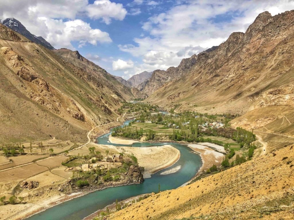
The Pamir Highway (officially the M41) winds its way from Tajikistan to Kyrgyzstan through a region of soaring snowcapped mountains, rocky valleys, barren plateaus, and high-altitude passes. Climbing to its ultimate height at 4,655 metres, it’s the second-highest highway on earth. No wonder then, that the Pamirs are also called ‘The Roof of the World’.
Self-driving the Pamir Highway is definitely one of the world’s ultimate roadtrips. Thinking about taking it on? In this guide to the Pamir Highway I’ve outlined our eight day itinerary, and provided information to help you plan your own trip:
Transportation
Self-Driving the Pamir Highway
On the Road – Our Itinerary
Before You Go – Planning Your Trip
Osh, and Moving On
If you like roadtrips then this one has got it all. In case you’re wondering what you’ll find along the way, I’ve written another post about the very best of what we saw and did. Check it out here:
An Epic Roadtrip: Adventures on the Pamir Highway
Note: we did this trip in 2019 so costs as specified in this post will have gone up.
Transportation
There are a few different ways you can travel the Pamir Highway. Cycling is an ever-popular option (and I salute anyone who accomplishes this feat). Otherwise, the main options are:
- Car and Driver. This is the most popular way to go. You can book onto an organised tour (the most expensive option), or you can hire your own private car with a driver (so, essentially also a tour). You can do this alone or you can band together with other travellers you meet in Osh or Dushanbe. You are along for the ride and don’t need to worry about anything, although you can plan your stops and detours.
- Public Transport. The cheapest way to go is hitchhiking or public transport. This will take extra time waiting on rides and you can’t count on going exactly where you want or stopping whenever you want to take photos, hike, and so on, but it can certainly be done.
- Self-Driving. You can drive your own car or rent one without a driver. Self-driving costs a lot more than public transport but can cost slightly less than hiring a car with a driver. We opted to rent a car and self-drive because we knew it was the best way to get what we wanted from the trip: total independence, and being fully in charge of our own plans and pace.
Self-driving the Pamir Highway
Oyv and I are in no way strangers to long, agonizing trips on unreliable and sometimes downright dangerous public transport. In fact we relish it and very often set off to do exactly that – just have a look at the trips on this blog. We’ve taken on large swaths of Africa by public transport and that is no small feat. But in this case we decided to hire our own car and self-drive the Pamir Highway. That brought with it some different considerations, which is why I wrote this post.
If you decide to hire a car and self-drive the Pamir Highway, here are some things to think about:
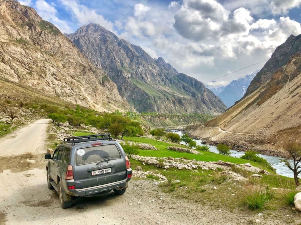
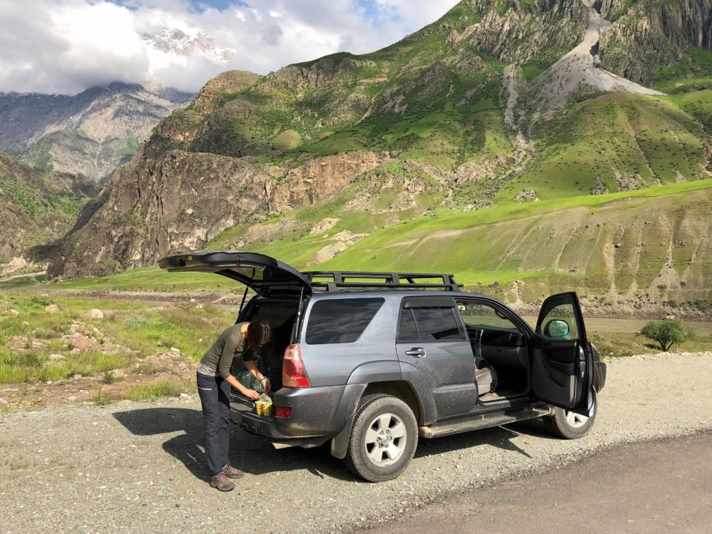
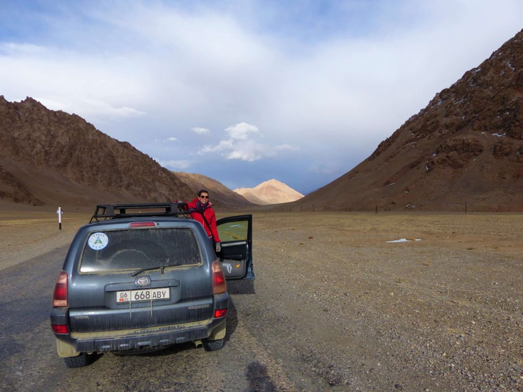
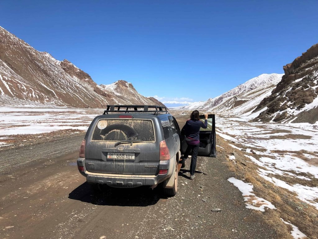
- Finding a car. There are a few resources for car hire available. IndyGuide and Caravanistan list several agents who hire out cars in both Kyrgyzstan and Tajikistan. Expect to pay around 100-130 USD/day (plus fuel) for a reliable 4WD vehicle. We had a Toyota Forerunner which was perfect for the trip.
- Pick-up and Drop-off. The highway goes from Dushanbe to Osh (or vice versa) and unless you want to drive it twice you’re going to be picking the car up in one city (not to mention country) and dropping it off in the other. Most car providers handle this by charging a fee of around 150 USD to bring the car to your start point, or, to pick it up where you’ve left it.
- Collecting the car. Check it over really carefully in daylight, inside and out, before you sign off and pay up front. You’ll also need to fork over a deposit in cash, usually around 500 USD. Get familiar with all the documents in the glove compartment – these are permits and a passport for the car, which you’ll need at checkpoints and at the Tajikistan/Kyrgyzstan border when you take it across.
- Insurance. It’s not going to work the same way as it does in Europe (or whatever): for example, there’s no third-party insurance. So just don’t hit anyone.
- Kilometers. Our car had a 400 km/day limit which the owner said we could exceed without charge – but that exceeding it is extremely unlikely on these roads (and also unnecessary).
- Fuel. We topped up the tank whenever fuel was available and tried to stay as close to full as possible. It’s also more expensive the further you go so definitely fuel up in larger towns where possible.
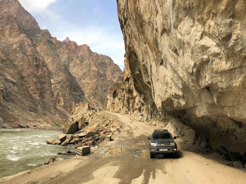
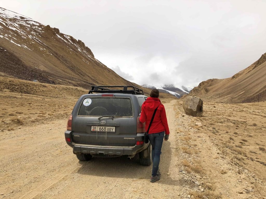
- Road conditions and traffic. The roads vary constantly from muddy tracks, to once-paved roads crumbling into potholes, to smooth pavement, and so on, but are often a lot better than you think. Traffic isn’t really an issue: at this time of year, we could drive for hours without seeing another vehicle. You will meet convoys of big trucks, and you better hope there is room to pull over. In the Wakhan valley especially, there are a lot of animals and people on the roads to watch out for.
- Checkpoints. There seems to be a lot of talk about soldiers at checkpoints demanding bribes, especially from unaccompanied foreigners driving rental cars, but in our experience we didn’t have a single issue. No one ever demanded or even hinted for a bribe or tried to hold us back.
- Driving. Last but certainly not least, consider your driving skills. You’ll be driving on mountain roads, and probably off-roading too. Depending on the time of year, you may get almost anything weather-wise.
On the road: our itinerary
This post is about our experience self-driving the highway from Dushanbe to Osh in eight days, but you can certainly adapt any part of our itinerary to suit yourself with a car and driver or by public transport.
All the driving times here include a lot of stops to look around, take photos, walk, make coffee or eat lunch.
DAY 1 – Dushanbe to Kalai-Khum
Departed Dushanbe: 10.30 am
Arrived Kalai-Khum: 6 pm
It’s about 170 kilometers from Dushanbe to Kulob, where we filled up the tank. It’s then another 200 kilometers on to Kalai-Khum.
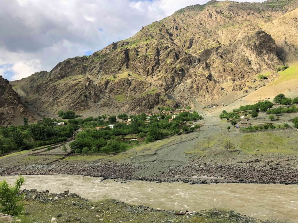
Driving in the Pamirs gives you a pretty unique view – right into Afghanistan. After Kulob, you can start peering across the Panj river and into Tajikistan’s infamous neighboring country. There are villages built into the hills on the Afghan side and you can see people going about their lives.
We stopped to make lunch near the first border bridge.
In Kalai-Khum we stayed at Darvoz guesthouse, which is actually just outside of town. We paid 30 USD for two for bed and breakfast. There is WiFi at the guesthouse and a restaurant just over the bridge in town called Oriyana, where we spent a grand total of 3 USD on dinner for two.
Roads: mostly good condition. Some potholes and broken asphalt right after Kulob for 15-20 kms, and it deteriorates again for the last 30 kms to Kalai-Khum. We passed two checkpoints with no issues, simply showed our passports and the car documents.
Time: 7.5 hours
Kilometers: 370
Cost for fuel, accommodation and meals for two: 55 USD
DAY 2 – Kalai-Khum to Khorog
Departed Kalai-Khum: 9 am
Arrived Khorog: 6 pm
This is where you’ll probably do the long-haul of the trip, Khorog being the unofficial ‘gateway’ to the highway. Before leaving Kalai-Khum we filled the tank again.
Khorog is either your first real sign of civilisation in days, or your last one (depending on whether you’re coming from Osh or from Dushanbe). If you’re just starting out, it’s your last chance to grab more cash or groceries.
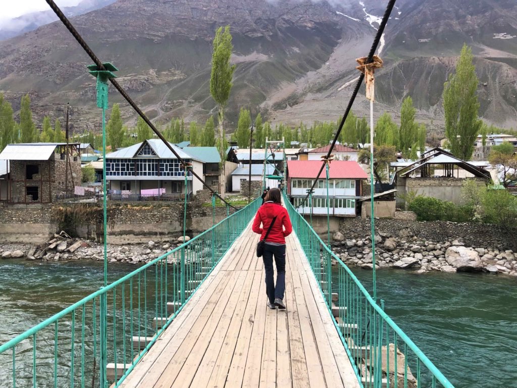
Besides hotels, restaurants and other signs of life in Khorog, there’s also a Botanical Garden high up above the city with nice views, and a pretty bridge crossing the river in town. There are some parks and museums here too.
In Khorog we stayed at Riverside guesthouse, a very friendly and comfortable place with a kitchen where our own breakfast supplies came in handy. They have WiFi and we paid 17 USD for two (no meals). There’s an Indian restaurant in Khorog which I can’t really recommend for the food itself, but it’s cheap and handy – 11 USD for two curries, two rice, two sodas.
Roads: mostly bad and rough, deteriorated asphalt until the last 70kms into Khorog where it improved. Two checkpoints on the way.
Time: 9 hours
Kilometers: 240
Cost for fuel, accommodation and meals for two: 44 USD
DAY 3 – Khorog to Ishkashim
Departed Khorog: 11.45 am
Arrived Ishkashim: 5.30 pm
We filled up the tank again before leaving Khorog. Then we left the actual highway and drove into the Wakhan valley; this is the first, and major, detour on most Pamir trips. You can save a couple of days by remaining on the highway and bypassing the valley, but you’d be missing out on what is for most people (including us), a major highlight. Over the day we gradually climbed to an elevation of 2547 metres.
This was an awesome day, a very scenic route following the Afghan border, and filled with short detours off the road:
- Garam Chashma. Hotsprings that I’d recommend dropping. They’re very artificial.
- A steep (scary) hairpin road up to Dasht village. Stunning views over the valley.
- Out of nowhere the road turned into soft white sand along the river, so that’s where we stopped for our picnic lunch.
- Throughout the valley locals get around by hitchhiking. We picked up a lot of passengers, which was fun.


Reaching Ishkashim you pass a border bridge to Afghanistan. There’s a weekly market held in the no-man’s land here (I believe it’s on Saturday mornings – but we were not in town that day).
In Ishkashim we stayed at Ren guesthouse, which served by far the best food of the trip. It’s quite new and the room was really nice. We paid 30 USD for two people, for dinner, bed and breakfast.
Roads: OK off and on. Very narrow in places. Crumbling asphalt, sand, gravel, potholes. Two checkpoints.
Time: 5.5 hours
Kilometers (not including short detours): 105
Cost for fuel, accommodation and meals for two: 62 USD
DAY 4 – Ishkashim to Langar
Departed Ishkashim: 8.45 am
Arrived Langar: 6 pm
Like the first one, our second day in the Wakhan valley involved a lot of beautiful little sidetrips. All were marked on Maps.me and just a matter of turning off the road from time to time for short distances. Over the course of the day we reached an elevation of 2892 metres.
- We climbed up to the top of Khaaka Fortress.
- At Darshai Gorge we spent about two hours hiking a trail overlooking the gorge. With a guide from the village you can continue on a day or overnight hike to some valleys beyond.
- Maps.me showed ‘Emergency Shelters’ all over the route, so we checked one out. Not sure what they are for sheltering from, but if you need one, you can find one.
- An exciting drive up to Yamchun Fortress, creeping along hairpin turns right up to the ruins of this Silk Road fort.
- A short drive further on from the ruins we reached Bibi Fatima, hotsprings renowned for what else than healthful benefits. Entrance is 10 somoni (1 USD) per person. Leave your valuables in the car as you take nothing, and I mean nothing, no clothes allowed – into the springs with you. There are separate sections for men and women.
- We climbed up to a Buddhist stupa behind Vrang village. It’s easy to find but we were still escorted there by every kid in Vrang.
- We drove through another beautiful patch of sandy dunes on the way to Langar and stopped there for lunch and coffee.


In Langar we stayed at Nigina guesthouse which cost 30 USD for two for dinner, bed and breakfast.
Roads: in general OK – gravel, dirt, sand. One minor landslide blocked the road and held us back for few minutes, workers were already there clearing the rubble away. No checkpoints.
Time: 9 hours
Kilometers (not including short detours): 122
Cost for hotsprings, accommodation and meals for two: 32 USD
DAY 5 – Langar to Murgab
Departed Langar: 9 am
Arrived Murgab: 5.30 pm
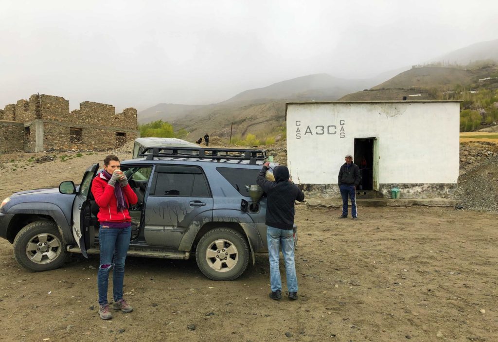
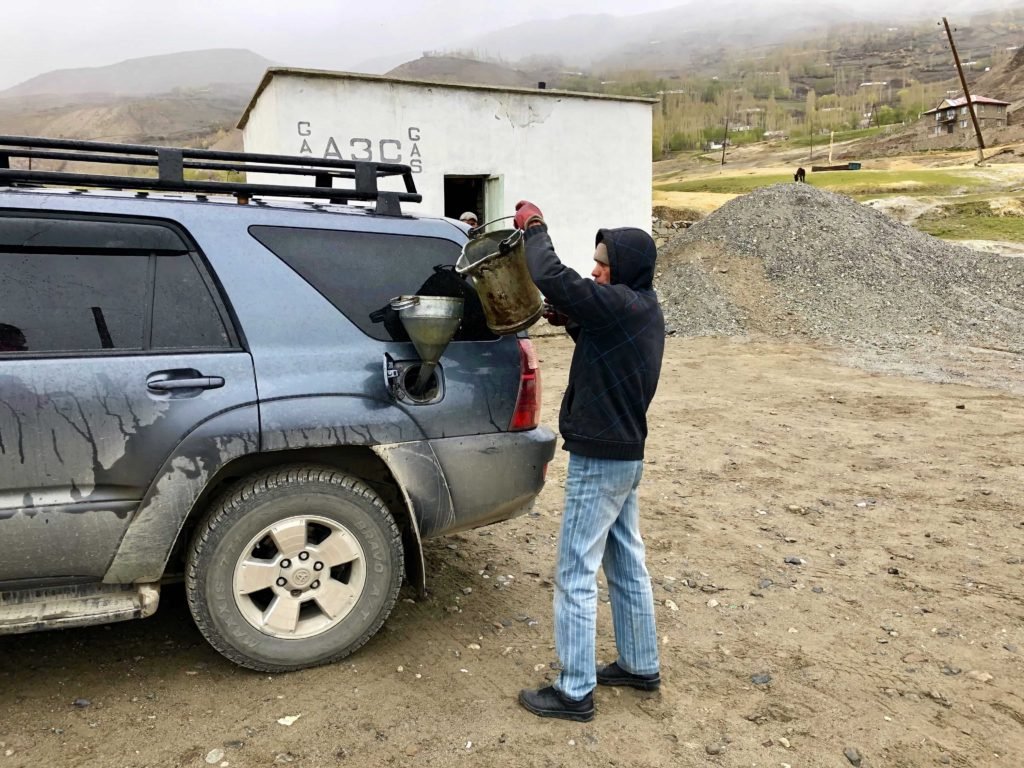
We filled up the tank in at a gas station in Zong. And by ‘gas station’ I mean, a guy with a jerrycan and a big metal funnel. Fuel is noticeably more expensive out here than back in larger towns.
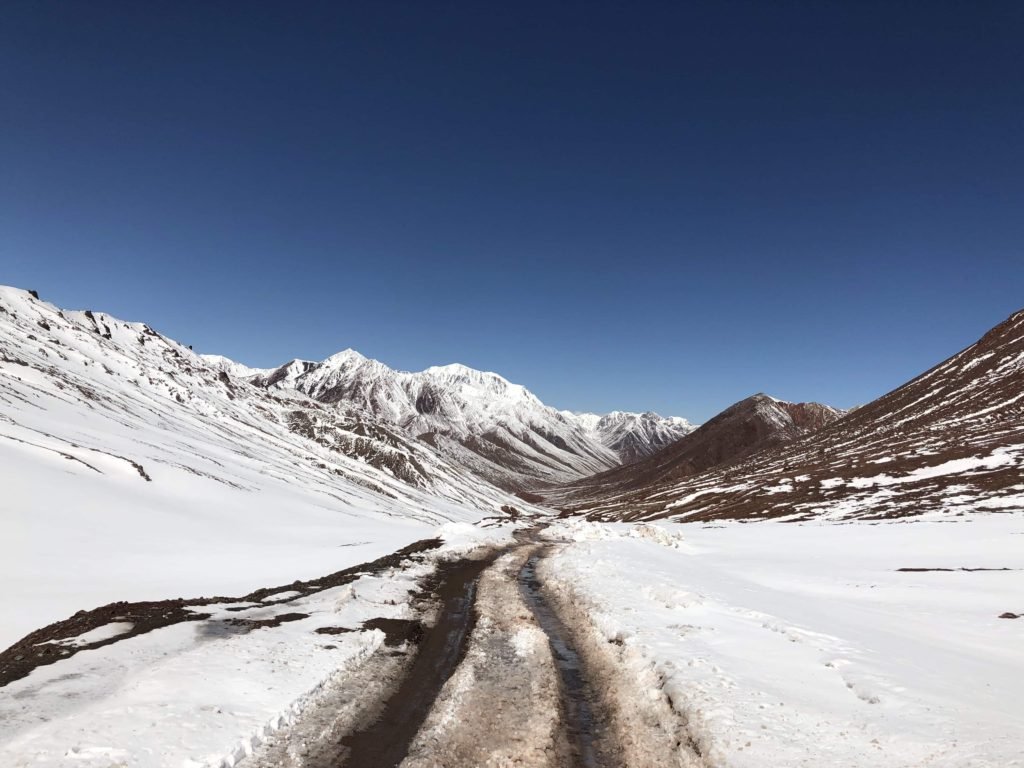
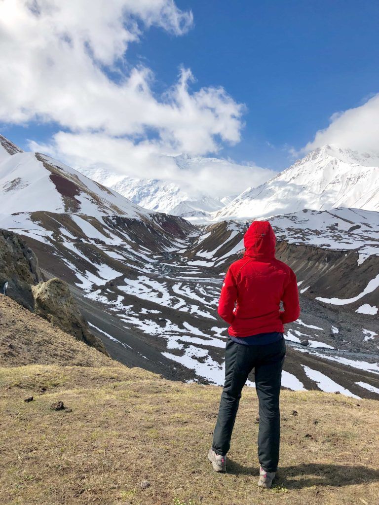
The 116 kilometers from Langar to Bulunkul took about 4 hours due to a blizzard on Khargush pass where you climb out of the Wakhan valley and back onto the Pamir Highway. There was a lot of snow accumulating on the ground, it was steep and slippery, and we could barely creep along at a snail’s pace. It was a scary drive (or fun, depending on which one of us you ask). There is a spectacular view of the Hindu Kush (Killer of Hindus) mountains between Afghanistan and Pakistan. Once the skies cleared, we saw several camel caravans slowly plodding along on the Afghan side.
After that the road gradually veers away from the Afghan border. We took the cutoff to Bulunkul – the coldest town in the country – and stopped at the lake to look around at the yaks on the shore.
From Bulunkul to Murghab it’s another 145 kilometers. On the way we drove off-road to get a closer look at a beautiful green lake. We passed a couple of villages including Alichur; the scenery up here is ghostly and bare (you’re up around 4000 metres so no wonder), and there are some mountains with mineral layers.
In Murgab we slept at Sary Kol guesthouse, where the owner is really friendly and has put a lot of effort into his place. We paid 12 USD per person for bed and breakfast. We ate dinner at a hideous cafe in the shipping container bazaar.
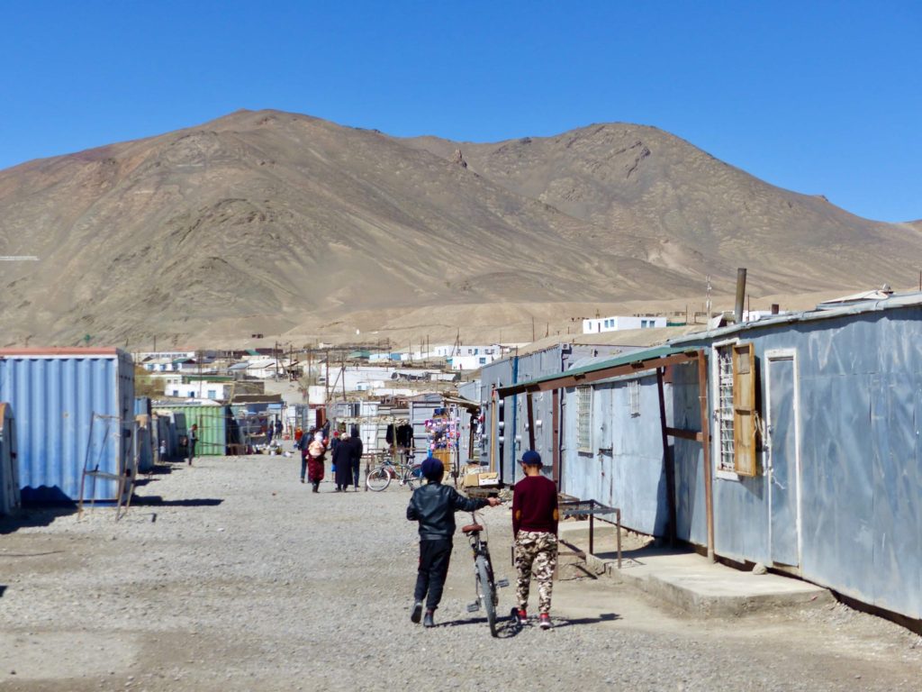
Murgab is definitely worth a look around. It’s remote, desolate and the bazaar is made from shipping containers. The houses are low flat-roofed bungalows but you can see that people have been making efforts to brighten the place up. And of course, there’s a Lenin statue.
Roads: the M41 was surprisingly bumpy, full of potholes until about 30 kms out from Murgab. We averaged a speed of around 30-50 kph. There was a checkpoint on way over Khargush pass where we needed to leave copies of our passports and visas.
Time: 8.5 hours
Kilometers: 261
Cost for fuel, accommodation and meals for two: 49 USD
DAY 6 – Murgab to Karakul
Departed Murgab: 9.30 am
Arrived Karakul: 1 pm
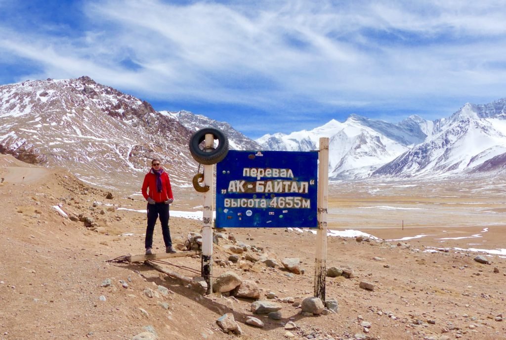
We filled the tank in Murgab. Then we headed to Rangkul, another beautiful alpine lake about 35 kilometers off the highway. From there we carried on to Karakul over Ak-Baital pass, the highest pass in Tajikistan at 4655 meters.
After that the road trails a barbed wire fence marking the neutral zone between Tajikstan and China.There are tons of holes in this fence but to slip through one is not to visit China…just no-man’s land.
In Karakul we stayed at a homestay called Algerim, where we paid 10 USD each for dinner, bed and breakfast. We arrived early and used the time to relax in our big bright sunny room with lots of chai, next to a stove which our host continually filled with yak dung and stoked the fire. I had the best bucket shower of my life there (I’ve had a lot of bucket showers). The washroom is a little mud-walled stall in the backyard, with a tin pail of water simmering on a glowing stove. It’s toasty warm, despite being in the backyard of a house in Karakul.
Roads: there was a checkpoint on the way into Karakul.
Time: 3.5 hours
Kilometers: 136 km including Rangkul (100 km straight from Murgab to Karakul)
Cost for fuel, accommodation and meals for two: 60 USD
DAY 7 – Karakul to Sary-Mogol (Kyrgyzstan)
Departed Karakul: 9 am
Arrived Sary-Mogol: 3 pm
It’s only a one hour driver from Karakul to the border with Kyrgyzstan, where we stopped at the first post on the Tajik side for chai and paperwork. The guards were super friendly, they gave us candy…there was no talk of bribes. The second post is a few minutes further on, where you do papers again for customs, and they’ll take a cursory glance over the car. We spent about half an hour on the Tajik side (mostly listening to Afghan music and drinking chai with the guards).
It’s a 20 kilometer drive over Kyzyl-Art pass to the Kyrgyz side for another half hour processing immigration and customs. The guards were friendly, and jokey – ‘Any drugs, bombs?’ and ‘Why not?’ were their two questions to us.
Driving over the pass we noticed countless cute gophers standing up on top of their little hills. We drove straight on to Sary-Tash and from there on to Sary-Mogul.
We stayed in Sary-Mogol at a CBT guesthouse where we paid 1300 Krygyz Som (18 USD) per person for dinner, bed and breakfast. Food improved pretty drastically at this point, but that is not saying much. The guesthouse also had WiFi.
Roads: Kyzyl-Art pass was snowy and muddy but easy fun driving.
Time: 6 hours
Kilometers: 125
Cost for accommodation and meals for two: 38 USD
DAY 8 – Sary-Mogol to Osh
Departed Sary-Mogol: 1 pm
Arrived Osh: 4 pm
We filled up the tank twice, once in Sary-Tash and again in Osh.
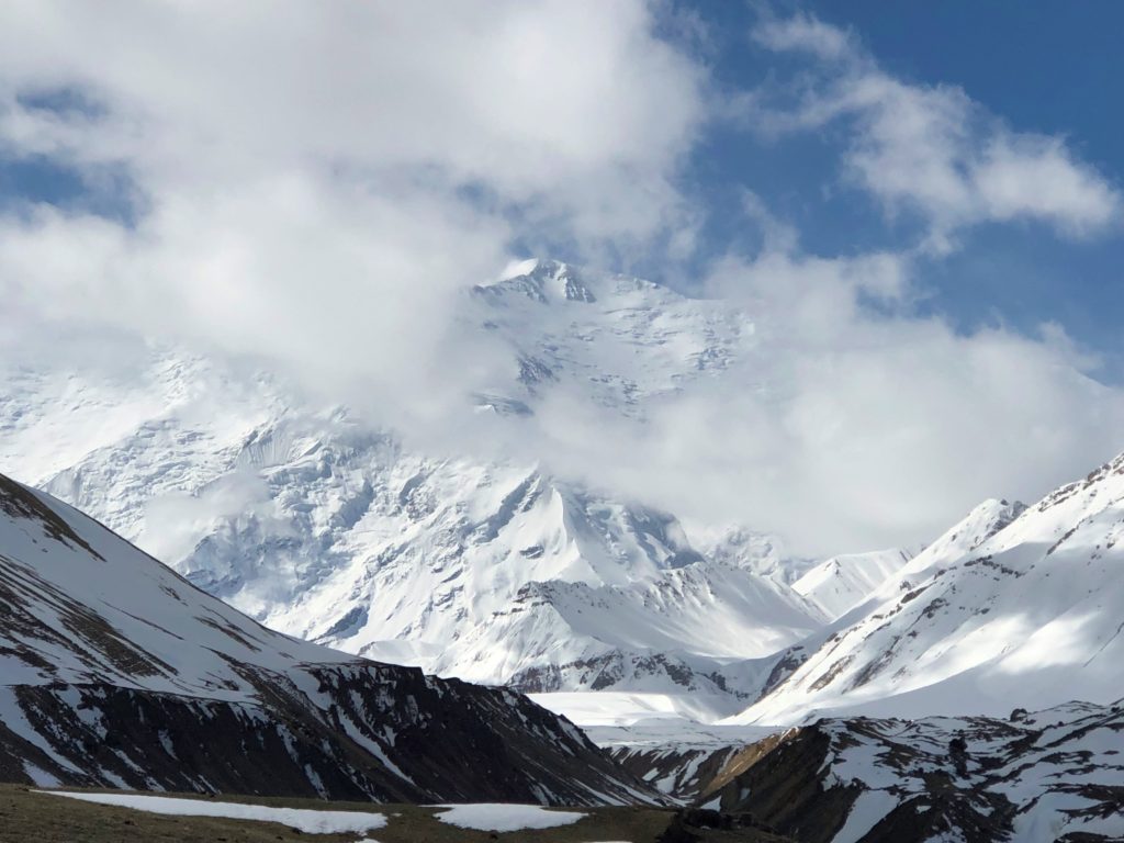
After breakfast we drove 21 kilometers out of town towards Peak Lenin until we hit deep snow and left the car. From there we walked another 3 kilometers to Tolpur-kul (a lake).
In summer you can drive whole way, but it makes a nice hike with great views. In the distance you can see Peak Lenin peeking out of the clouds. From this point it’s another few hours trekking to the first base camp.
After the hike we returned to the car and drove the last three hours of the trip, to Osh.
Roads: all good, beautiful views of green and red mountains – and a rockslide on the way to Osh.
Time: 3 hours driving
Kilometers: 219
Cost for fuel: 45 USD
Before you go – planning your trip
There’s no need to nail it all down. A trip like this is a ‘Choose Your Own Adventure’. The highway itself is approximately 1250 kilometers but you’ll probably add onto that with detours. There are many of these, the most famous one being the Wakhan Valley. Depending on the time frame you are working with you should read up on your options in advance and at least have a rough idea of what you’d most like to see or do.
When to Go
Where to Start and End
How Many Days
Things to Bring
Sleeping
Costs and Money
Keeping in Touch
When to go
We picked early spring (the very end of April) and without any other seasons to compare to, I would still say that that was the best time for us. The weather can be unstable and certain areas can be off-limits due to snow. But for the most part we had sun and the major advantage over summer is that there were no crowds: no advance bookings needed, and we usually had the road and sights along the way entirely to ourselves.
Where to start and end
You can start in Osh (Kyrgyzstan) and end in Dushanbe (Tajikistan), or vice versa. Starting in Osh means that on the very first or second day, you’ll quickly ascend to over 4000 metres without almost any time to acclimatise and that can affect some people badly. There is also a lot of debate over in which direction the views are ‘best’ but it seems pretty evenly split and honestly, you can always just look behind you the way you came. For us starting in Dushanbe made the most sense, in connection with the rest of our travel plans in Central Asia both before and after the roadtrip.
How many days
It’s best not to rush or take on too much. It’s also a good idea to expect the unexpected. Especially in the spring time, weather can easily throw a wrench in the best-laid plans. On our way into Dushanbe from Penjikent a rockslide closed the road and held our share-taxi and all the other traffic up for 5 hours. It wasn’t a problem and the best part was that our car wasn’t actually under the rockslide. Plus, you never know when you may want to stop and linger somewhere amazing (or leave some place you aren’t so keen on).
Eight days was a very comfortable amount of time to do what we wanted without feeling rushed at all.
Things to bring
- Visa, Permit. Getting an eVisa online is fast and painless. The part of Tajikistan you’ll travel through is called Gorno-Badakhshan, and it’s a separate region with its own entry requirements. You’ll need a GBAO permit, and it’s very easy to get – just flag the box on the eVisa application. The two together cost 70 USD. Print the visa out and bring it.
- Cash. Between Khorog and Sary-Tash there are no ATMs. Bring some USD with you to Tajikistan as even in Dushanbe you may not want to count entirely on ATMs. Before leaving Dushanbe we changed most of our USD to Tajik somoni, as the rate in the mountains is terrible. We paid for everything – except the car – using somoni and kept a couple hundred dollars as an emergency stash.
- Documents. Bring a few photocopies of your passport photo page and your printed visa/permit. At some checkpoints you will need to provide the guards with these copies.
- Maps.me is pretty indispensable. In addition to the actual route a lot of detours, stops and homestays are marked on it as well.
- Powerbanks. You’ll probably be able to charge your devices via a usb in the car, and at night at your homestay, but a powerbank or two is a good idea.
- Music. We obviously had music on our phones, and also brought a speaker. We’re still haunted by the time we spent a week driving around the Australian outback and only had a CD of Sumatran gong-music we’d picked up in Indonesia on the way.
- Flashlight. For night time bathroom trips, if nothing else. Which reminds me: toilet paper.
- Thermos, cups, spoons. Every morning we asked our homestay to fill our thermoses with boiling water, and we made coffee and soup on the way. Our car also had a gas bottle and burner on board (and a tent and sleeping bags too).
- Food and water. We brought all our water with us. We also brought lunch-type food and snacks for the road. Before setting off, we grocery shopped at the Auchan in Dushanbe which is a pretty good supermarket. Most days we ate lunch picnicking in the wild and it was not only really nice, but also convenient. Honestly eating at homestays for dinner and breakfast is enough greasy eggs, fried potatoes and tough meat as it is, without stopping for more of it at lunch as well.
Sleeping
Other than camping accommodation is mainly in the form of homestays which are everywhere. They are pretty basic but absolutely do the trick and are certainly an authentic way to experience life in the Pamirs. In some cases owners have really made obvious efforts to create a little travellers’ oasis – others are more like, ‘here is some space where you can sleep’. They have shared and private rooms, some with beds and in others you sleep on mattresses on the floor. The (flushing) toilets are often outside (sooo cold at night!). A night at a homestay typically costs 10-15 USD per person and includes dinner, bed and breakfast.
We didn’t book a single night in advance. On www.pamirtop.com you can find and book homestays and www.visitpamirs.com gives some in-depth information about homestays.
Costs and money
Your daily budget will need to include fuel, accommodation and meals on the road. For example, we spent:
- 38 USD at a supermarket before leaving. This worked out to about the right amount of food and water (and some vodka).
- a total of 173 USD on fuel, including a final top-up before returning the car.
- between 10-15 USD per person per day for dinner/bed/breakfast at a homestay.
In total we spent about 385 USD on the road, or 48 USD per day for two.
Add to that a car costing approximately 100-130 USD per day, and 150 USD for the pick-up/drop-off fee, and you’re looking at around 1,335 USD to 1,575 USD for an eight day self-driving trip (for two people).
IMPORTANT – remember to bring all the cash you will need for your daily expenses. There may be an ATM in Murghab, I’m not sure, but other than that there are none between Khorog and Sary-Tash. We actually brought way too much cash with us on the road; 4000 somoni for the eight days would have comfortably covered us both with some left over.
Keeping in touch
- WiFi. Don’t expect to be posting your entire trip. You probably won’t get online (unless you’ve got data, and maybe not even then) in between Khorog and Sary-Tash.
- Phones. We didn’t buy a local SIM and didn’t need one either. We did have signal on our phones on the road from time to time and every night in town.
- Other drivers. We knew of two or three other cars with hired drivers who were taking groups on the road at the same time as we were on it. We ran into them from time to time and could check in with the drivers, ask about the road ahead, and so on. Actually two of these local drivers complimented Oyv’s driving and this spurred him on to new heights of confidence and speed, so I was mostly sorry we’d met them…
Osh, and moving on
After our walk in the foothills below Peak Lenin we drove the last scenic, mountainous stretch of the Pamir Highway to its very end in Osh, Kyrgyzstan.
Ironically, after navigating all those steep, twisting, crumbling mountain roads (not to mention a high-altitude blizzard) Oyv found driving through Osh was the worst part, driving-wise, of the whole trip. Osh is a little chaotic and messy, especially if you arrive at rush hour after eight days in the Pamirs, where sharing the road with two other cars feels like a bit of a traffic jam.
‘It’ll be nice to get to Osh and eat some…shashlik?’ we’d said to each other one night on the road over yet another dinner of leathery meat and potatoes, with stale bread and damp cookies. So we went straight to Brio, a cafe in Osh that does good coffee and cake (and no shashlik, thankfully). It was hot and sunny and we were feeling pretty great. The trip was fantastic and we lingered over our coffees with a sense of accomplishment, thinking over everything we’d just seen and done.
Early the next morning we were off, again – heading back to Almaty, Kazakhstan. From Almaty Oyv was heading home but I had some more things to do in Kazakhstan.
Read More
Check out the rest of my stories from the road, for more of my adventures (and misadventures) in Kazakhstan, Kyrgyzstan and Uzbekistan.
This Post Has 21 Comments
Happened to come across this and find my name. Thanks for the mention, guys, and enjoy the trip!
No problem – and thanks, it was a fantastic trip for sure!
Hi Sarah. Great article- I am currently planning a similar trip.
What company did you use to rent the car? The ones I have contacted don’t seem to offer drop off in Osh.
Thanks! You’ll have a great time, that’s for sure. We got the car from VisitAlay, and they arrange for pick-up/drop-off in both Dushanbe and Osh.
is it mandatory to use a 4×4 vehicle? I’m from Indonesia, planning to take the vehicle there, is the Toyota Innova able to pass Pamir Highway smoothly? Because innova is 4×2 passenger car, and with 189mm high ground clearence but i intend to take it and make lasting memories.
Hey! A 4×4 isn’t mandatory, but I think it’s the best way to go. There are places you might not be able to access otherwise, or might have to turn back.
It’s an amazing trip, you definitely will make some memories!
What an amazing trip and thanks for sharing in so much detail! Where did you rent the 4×4 in Dushanbe? It sounds like you dropped it off in Osh, right?
It was absolutely amazing:) We got the car from VisitAlay. They’ll arrange pick-up/drop-offs in both Ish and Dushanbe. We dropped it off in Osh, yes. A driver had dropped it in Dushanbe, we picked it up there, dropped it in Osh…and so it goes.
Thanks for this article! I’m planning to do a similar drive with my husband in September. You mentioned the car you rented had a tent, sleeping bags, etc. Did they come with the car and did you ever use them?
No problem! The tent and sleeping bags came with the car – it was just a last minute thing he threw in for us. We didn’t end up using them, but if you have the option I’d say bring them:) But not strictly needed, no. Have an amazing trip!
hi
I’m HOEN from South korea.
in your opinion, the road is dangerous to driving?
actually, i want to drive by my self, but my family don’t want that.
they think that it will be dangerous way.
please tell me your opinion!
thank you!
Hi! Sorry my reply is probably too late:( But I think it depends on how comfortable you are with that sort of driving (4×4, mountainous roads, etc) and, weather conditions. There are some scary bits if the weather is bad, but in summer time probably would be easier.
Grateful to you for your sharing your experience in details which enables to know how to plan my trip@@
I wonder if you know that I can pay US dollar for accommodation or I must pay their currency. Was the road very tough that car is likey to be damaged like having a flat tire or things like that?
Thank you
Hi, glad it’s helpful, you’re welcome:) We only paid in local currency, Somoni. I would *guess* that dollars would work, and we always have a stash of some dollars just in case, but it’s easy to just withdraw local before you set off so I would just do that. Or, you can ask around before you leave from Dushanbe. The road was pretty straightforward driving but of course, there’s always weather conditions to think about depending when you go. We didn’t get a flat but you never know (for example we just got a flat a few days ago, off-roading in Mongolia:)).
wow. Mogolia is really really fun! I wish I could visit there soon:)
Thank you for the quick response:) The reason I asked if the road was tough was I saw a youtuber who strongly suggests not to drive cause raod was so bad…. Another question of mine is , is it easy to find accomodation ( did you visit during smmer high season), I mean will it be crowded and your shared your room with other travelers ? And is it easy to be on the right way ( will i get lost!) if I use maps me?
Thank you:)
Well, I suppose the road can certainly deteriorate in places, and a lot of it will depend on your driving experience and confidence. We went in early May and did encounter some snow, some places we couldn’t access because it was too early in the season to off-road, and the road into Dushanbe from the border (ie before we got our own car and started on the highway) was blocked for half a day by a small landslide, which was cleared up and traffic resumed, but definitely falling rocks and stuff are more likely the earlier/later you go in the season. Weather is a factor – if you’re going in summer, that’s the best weather you can get. So, for us the road was ok but that is subjective I guess.
We had zero issues finding accommodation – in fact we were often the only ones at the guesthouse, because we were ahead of the season. I think it’s very different in summer and you may want to book ahead, or at least expect to share rooms. Maps.me worked like a charm, it’s all we used. One other thing to keep in mind in summer, if you’re worried about the road – I think you’ll often see quite a few other vehicles going back and forth, so you likely wouldn’t need to worry about getting stranded.
thank you greatly !!!!! :))))))
Hi sarah. You have provided a detailed account of your trip. Thanks for that. As my driving skills are not that good so do you have any idea about the procedure and estimated expenses of hiring a car with a driver? And where i can make such bookings?
Hi, sorry, I don’t know what it would cost. But it should be pretty easy to do, just search for car and driver in Dushanbe or Osh (and check reviews, definitely).
Great story!
Could anyone give me an advice about where to rent a car?
There is plenty of car companies, but they don’t allow you to cross the border to Tajikistan or other countries.
Do you need special documents for border crossings?
Or is it just: rent the car, get permits for regions, and go!?
Kind regards,
Bart
Hi! We rented our car through Visit Alay, and the border crossing wasn’t an issue (as long as it’s part of the plan in advance, it’s a documented part of the rental). So in our case anyway, it was just rent the car, and go. No regional permits required, either.